This walk starts at the south end of Pape Avenue and goes north until it meets with Donlands Avenue to go over the Millwood Overpass bridge (Leaside Bridge). The rest is the '+' part of the title - I crossed the bridge then curved west (along Millwood Road, then Southvale Drive), south on Bayview and finally east on Pottery Road to join up with Broadview (subject of another blog post). Click on any picture to see a big version! Also part of this map.
Pape Avenue is named after Joseph Pape, a Yorkshireman who had a market garden at the corner of Gerrard and Pape.
At the far south end of Pape is the Revival Film Studios.

Walking north, Pape at Queen Street East looking north.

Toronto paramedic services - formerly an old Police Station. On Pape Ave between Queen and Dundas.

Sikh temple on Pape.

Jewish cemetary just south of the Matty Eckler Centre. This was the first Jewish cemetery in all of Toronto. Established in 1849 and closed since 1930.
https://en.wikipedia.org/wiki/Pape_Avenue_Cemetery

Matty Eckler Community Centre and pool at Gerrard Street East and Pape. We spent MANY hours here with the boys!

Looking south from the walkway over the railway tracks, just north of Gerrard.

Good timing for a train coming by. Looking east - Gerrard Square to the right.

Pape Primary School - Pape and Langley Avenue.
From the TDSB site, Pape School "...began as a four-room school on April 10, 1899. The principal and two teachers taught six classes from Grade one to Grade three. As the population grew, several additions were made to the building from 1908 to 1914, with the newest wing built in 1958."

450 Pape Avenue - William Harris House (1901).
Some movies were filmed here, most famously perhaps being the Steven King novel-based 'IT'. Prior to some extensive renovations someone toured through it and took this video. Nice stairs! He goes up to the 2nd floor around 3:30 and to the 3rd around 7:15
For many years it was a Salvation Army home for unwed mothers. That has a bit of a dark past as shown here: https://www.originscanada.org/adoption-practices/adoption-realities/homes-for-unwed-mothers
It is Nellie's Shelter for Women and Children now - much more positive than the previous I hope.

This type of small bench has been installed in a few places on Pape.

Looking north up Pape Avenue 'a few years ago' - after it was widened but while streetcars still ran along it (and horses and carts).

Back to the present - ONO (One Night Only) Pizza seems to be here for much longer than one night now. Formerly Pape Pizza.

The Schmooz - great food.

Former Riverdale Presbyterian Church converted to condos.
And click here to see it a few years earlier.

Pape Public Library

And another historical picture - on the west side of Pape just south of Danforth was the Valley View Dairy (this picture looking north).

Pape and Danforth looking north. The NE corner is being proposed for a 49 story building! The NW corner is a Royal Bank building - formerly a Union Bank of Canada (which merged with Royal Bank in 1925)

A commercial block on the west side of Pape.

Then a cool looking tree stump caught my eye.

And a symbiotic tree and climbing vine.

Typical East York houses flanking a renovation with added story.

Agnes MacPhail Square and the 'new' houses (since we moved into the neighborhood) built in the area that used to be the track/field beside Centennial College - which is behind a couple of rows of houses centre right in this picture.

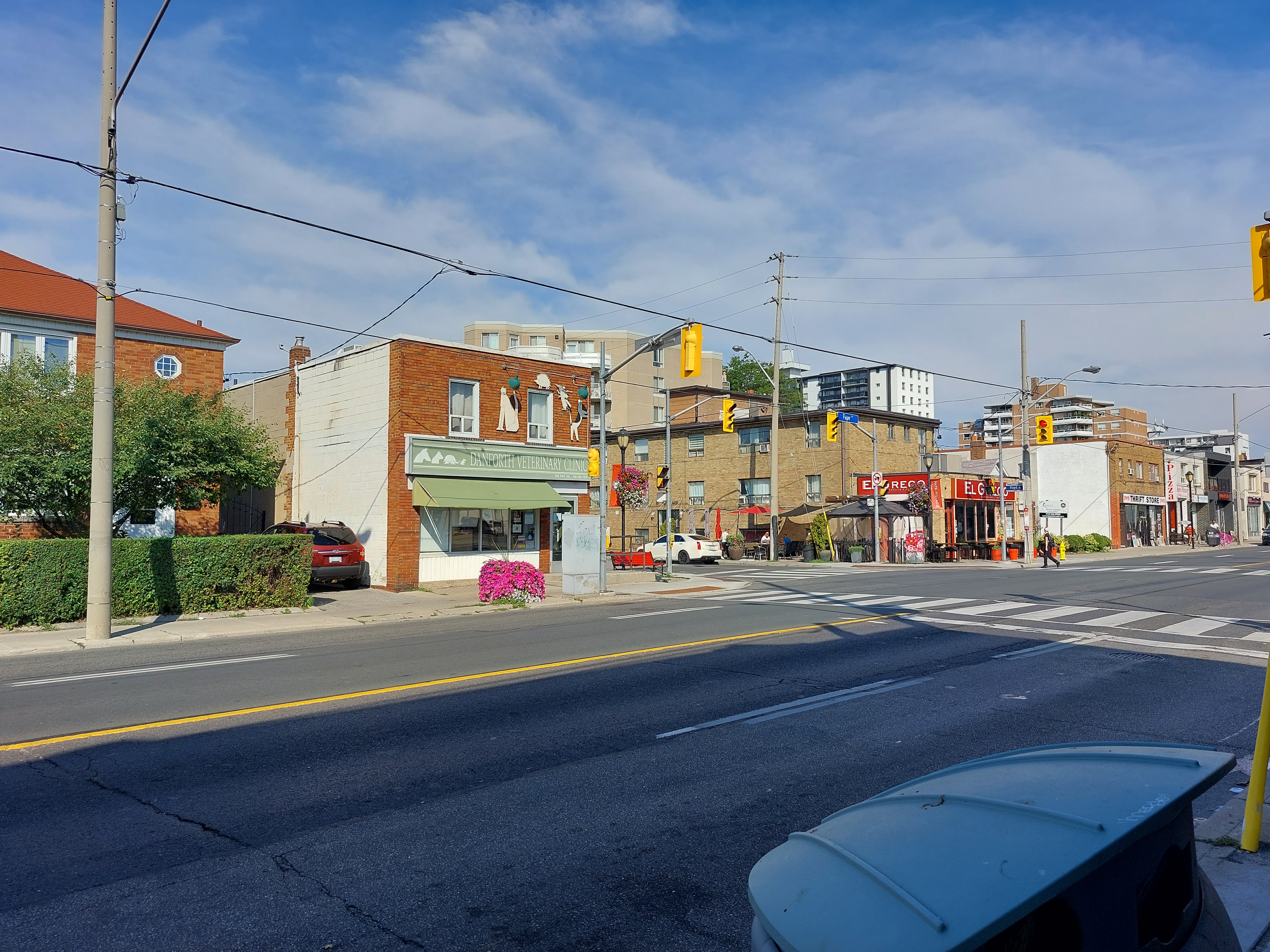
Our vet (Danforth Veterinary Clinic) and the El Greco restaurant (never been, but sounds good - https://www.blogto.com/restaurants/el-greco-toronto/)
Legion Branch. The 'statue' to the right on the wall is "Dedicated to the memory of Soldiers of Suicide"

Large cats at a home near the south end of the Leaside Bridge

Leaside Bridge. At this location I could feel it move when large vehicles went by. After all, it was built in 10 months. https://en.wikipedia.org/wiki/Leaside_Bridge

DVP still busy going into the city.

Close-up of the area to the far right of the previous picture. Turns out it's the North Toronto Wastewater Treatment Plant.


Leaside Arena (and curling rink behind it) at Laird Drive and Southwood.

Coming down Bayview Ave. Turns out there are some nice trails just 50 feet to my left that would have made for a nicer walk. Oh well.

The Bayview swing gates. Seem strange to me, but the idea is that they swing out over the road (a bit more each gate) to merge traffic during floods. A bit further south they have these on the northbound lanes at a low spot.
See also https://bayview-news.com/2022/01/bayviews-swing-gates-intended-to-merge-traffic-during-floods.html/

And suddenly some quiet at Pottery Road and the Don River

After crossing the Don River is the Todmorden Mills Heritage site. Originally a lumber mill (circa 1800), with brewery (added 1820), then riding stable and even German POW camp for a few years.

Saw this strange-looking sculpture(?) on the Todmorden Mills property but was getting too tired to take a detour so managed a shot from distance. There is a lot of art on this site (e.g. https://www.torontograndprixtourist.com/2022/04/artist-john-notten-flipping-canoe-and.html)

Then walked up the hill to Broadview and a combination of the temperature ("...feels like 39°..." at this point) and running out of water meant that I found he nearest public transit and ended the walk.
Great pics, as usual!
ReplyDelete