Sunday 19 July 2020

Etienne Brulé Park

We visited Etienne Brulé park a couple of times - in both cases starting near the Old Mill just north of Bloor and South Kingsway.

The first time, we headed north and walked along the Humber up through Lambton Woods (almost to James Gardens - will have to see that another day!)  The second trip (see later in this blog) we walked South.

Starting from the parking lot (near Old Mill Rd and Catherine St) you can see the Old Mill bridge over to the Old Mill.


We saw a few (a lot of) Canada Geese.

And a little reminder of a big storm that came through the previous week.

One good thing about this part of the walk is that it had a lot of greenery and cover from the sun. Also, the sound of the Humber (and its many - over 100 - weirs). Here's one - not a good idea to canoe over it.

Just before getting into Lambton Woods we crossed the Humber just south of the Dundas St bridge)

Then walked further north - with another reminder of the previous week's storm. 

Saw this little guy beside the trail (sorry for the lack of focus).

Some cool artwork underneath the Dundas St bridge

And a small visitor sitting on the side of the van when we returned :-)

For our second trip, we headed south from Old Mill Road. This was a lot less 'green' than the previous trip, but not without its interesting parts. Here is a view from the Old Mill bridge - showing our van in the middle :-)

Then we passed the Old Mill subway station.

And some neat murals underneath:


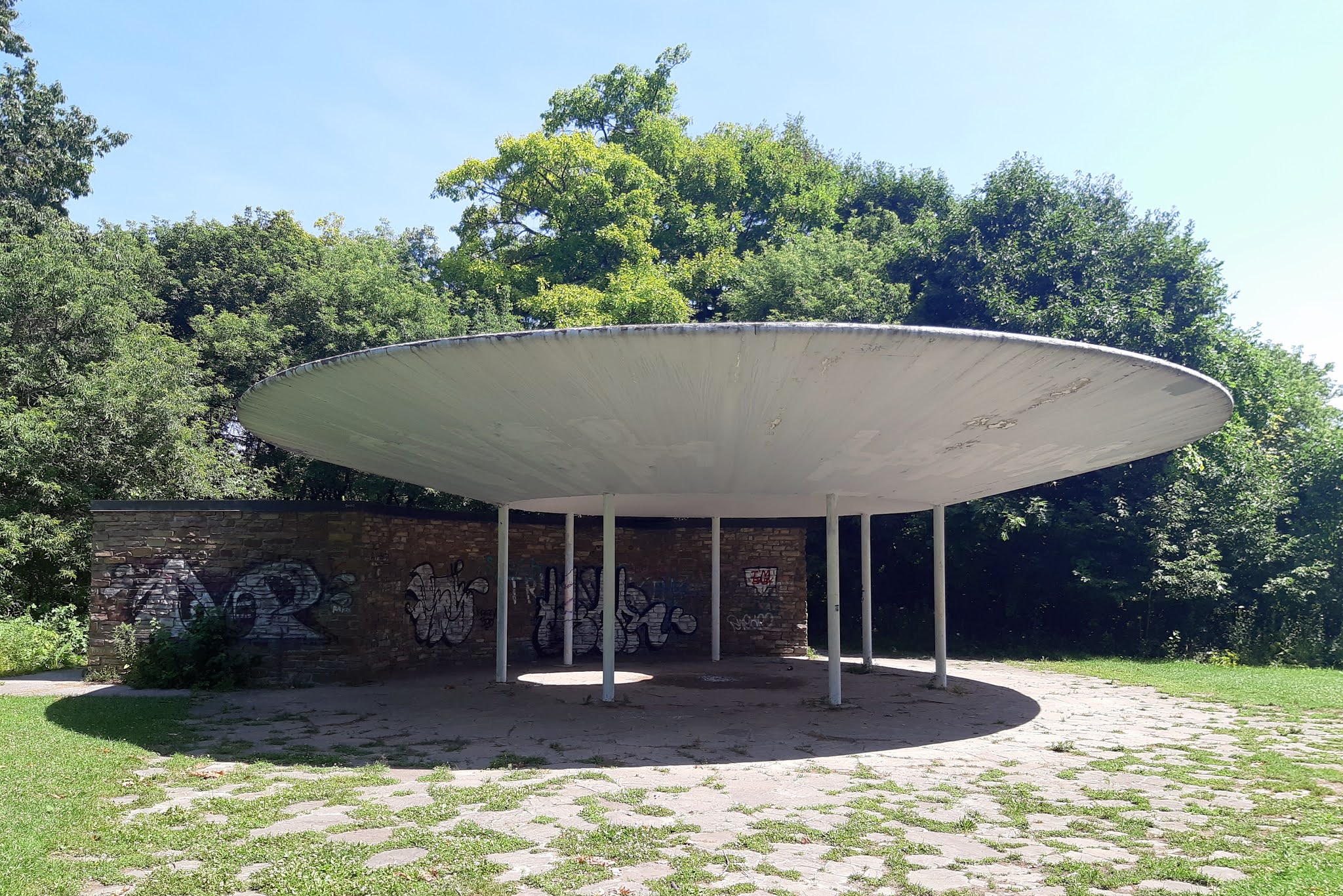
South of there we walked mostly on bike trails/roads. And there was one stretch of about 3-4 city blocks that we had to walk through city streets before getting back into the South Humber Park. Once there though, we passed this really cool 1960's looking abandonded washroom.

It has that 1960's vibe, so I looked it up and it is actually the South Humber Park Pavilion (or 'Oculus Pavilion') (see this PDF file for more detail) and was built in 1959.

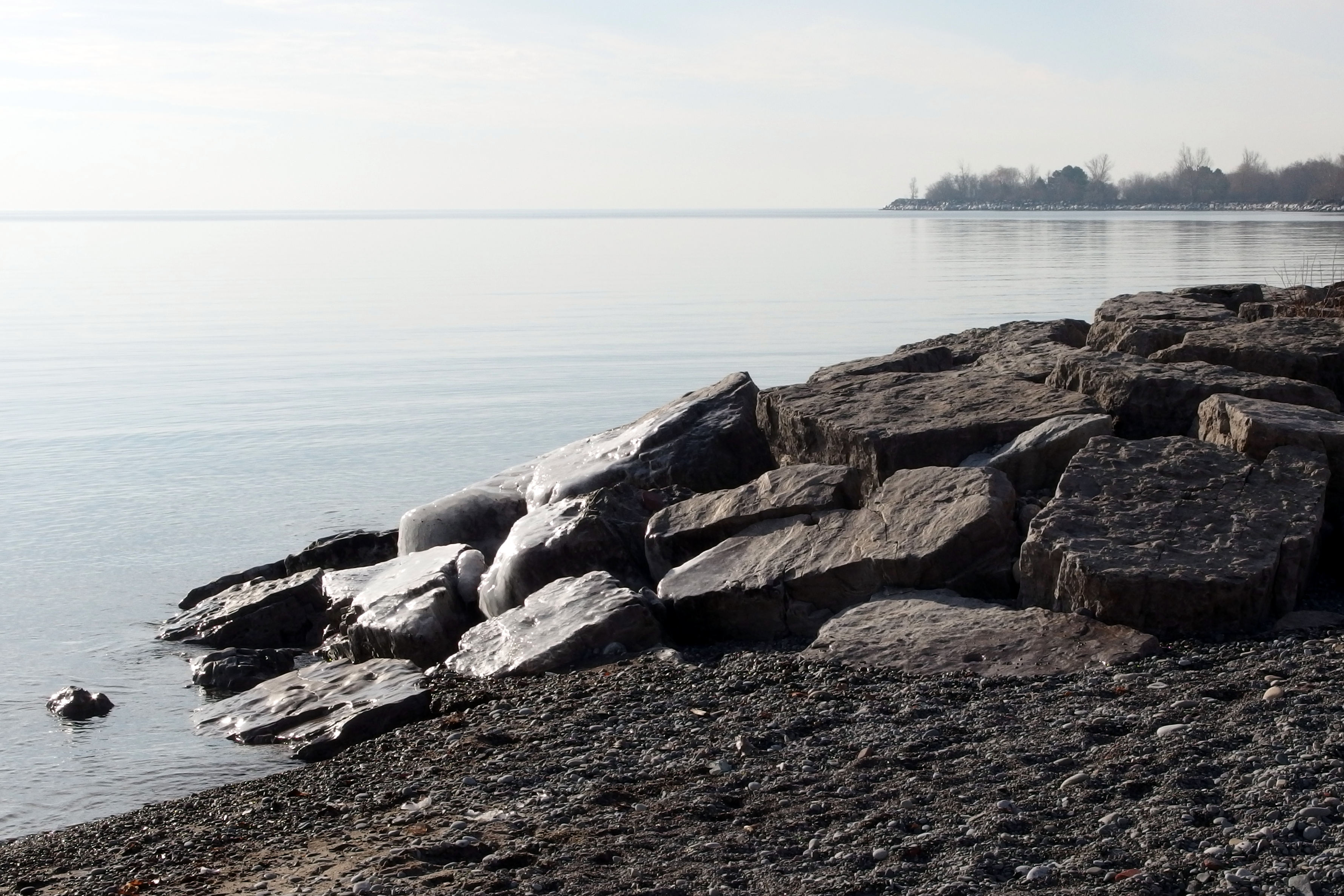
We walked down to Lakeshore, then decided to walk back along the other side of the Humber - going up Riverside Drive. I think to best see this part of the lower Humber you need to be on it!

While walking north on Riverside, we passed what looks to be an abandoned low brick walk-up apartment building (just north of the junction of South Kingsway and Riverside - here's a view from South Kingsway just for the heck of it) and then while thinking about how long that had been abandoned this house caught my eye. The vehicle didn't look like it had been moved in a while so I later looked up this property on Google maps.


Turns out that it looks good in 2009 (though the car doesn't seem to have moved an inch in that time!) and then some time before 2011 the tire went flat. And the 2015 picture actually shows a moving van out front that day! Though the vehicle remains and has slowly deteriorated since then. Seemed strange since this is such a desirable street - directly across from the Humber River with no houses on the other side so the view is 'locked in'. Maybe you can pick it up for a song?

(added) And then just north of here (and south of Bloor) there are some amazing houses. Huge mansions on large lots. For those who like looking at houses you will likely never be able to afford, include this area along with Rosedale, the Bridle Path, Forest Hill, etc, etc.


Saturday 4 July 2020

Mississauga's Riverwood Conservancy Trails

One of our walks this spring was to the Mississauga Riverwood Conservancy.

We drove to the parking lot at Burnhamthorpe Road W and Riverwood Park Lane. Near the parking lot is the MacEwan Terrace Garden (you too can be a gardener there!) with thousands of plants and a number of places to rest and look out over over a pond and the gardens in general. Unfortunately the City of Mississauga sites for MacEwan Terrace Garden are poor, badly organized, and incomplete. However if you go to this site it has a great description of the gardens and the trails.

We walked down to the Credit River, then followed the trail along it up to Hwy 403 and then back.
This was a great looking tree - perched on the side of the trail. Hope it stays for a good many more years.

Another trail picture of a 'canyon of trees'.


Then down by the river. Always nice to be beside running water.

And there are a number of low-lying areas beside (and along) the trails, so after a rain could be much wetter than what we saw. Still some areas when we went (a couple of days aftet the last rain).

Approaching the 403 there were a few interesting pieces of graffiti, a couple of which are shown below.


And just so you'll know when you're under the 403...

Heading back we ran into this little guy. Just one of many birds and animals (and spawning salmon at certain times of the year! The Culham trail noted in that link is one of the trails accessible from The MacEwan Garden and Riverwood Conservancy areas).

Another great walk and proof that Mississauga is not just endless suburbia and airports.

Friday 3 July 2020

Toronto Beaches, Boardwalk, and Ashbridges Bay

The Beaches, Boardwalk, and Ashbridges Bay are a great part of Toronto. We have walked these areas many times, so the photos below are from a number of years (not just 2020).

If you start at the East end of the boardwalk (or just past the end of the boardwalk actually) you will find the R. C. Harris water treatment plant (see my earlier post for some pictures).

The beach then runs for roughly 5 km with areas of beach, rocks, dog walking parks and picnic areas (mostly towards the western end).

Here someone is enjoying the wide open space of looking out over Lake Ontario.

(It's a little cooler in winter)

The size of the lake really makes it seem like an ocean sometimes.


Quite often there are Art installations on the beach. A few examples from over the years follow:


The boardwalk is flanked by sand on once side and mostly trees on the other (with various homes / apartments coming very close to the beach in places.


Lots of room for play

And for animals too.

Various parts are now being left to be more 'naturalized' (or perhaps they are carefully being 'naturalized', I'm not sure). Either way I like the combination of plants, trees and grasses.

And as you get to Ashbridges Bay there are more trees and some quiet areas (before you get to the marinas).

Finally, in the spirit of the times, remember to socially distance when visiting!

Thursday 2 July 2020

Third walk by the Scarborough Bluffs - Highland Creek

Walk #3 of ours along Lake Ontario went a little futher East than our last walk. We started at Lawrence Avenue and Beechgrove Drive and walked south through Lower Highland Creek Park.

Once we got down into the park the first surprise was just how high the Lawrence Ave bridge was!

(And if you take a shot in 'panoramic' mode, you can get a lot of distortion)

There has been quite a bit of erosion along the bank. Below is a section of the path that was actually closed off (there is a different path parallel to it). 

And from the other side:

The usual selfie, just before getting to the lake.

You cross under a railway line and are now at the intersection of Port Union Waterfront Park and East Point Park.


We walked east and along the water we saw a tagged trumpeter swan! Trumpeter swans are being tagged for study (this one is 'V02' - an improvement on 'V01' I assume). https://www.thestar.com/news/insight/2015/02/20/wild-in-the-city-restoring-trumpeter-swans-in-ontario.html

And some nice beach a little further along

Finally, when walking back (and just before getting to Lawrence) I took this picture of what turned out to be a water pipe across the ravine. (See the 'hiking the GTA' link at the beginning of this post). Looked cool and slightly 'futuristic' - at least compared to the 'back to the past' feel of walking through the ravine 😀