Monday, 31 October 2022

Walking Toronto Streets - The Port Lands

While many (most?) people seem to avoid the Port Lands I find them fascinating for some reason. Perhaps it is the large undeveloped areas practically in the middle of the city. Or the cool abandoned power plant (the old Hearn Generating Station). Or the trails and the Leslie Street Spit that started out as the city just dumping construction debris into the lake and is now a roughly 5 km long sliver of land extending into Lake Ontario and supporting a huge variety of birds and wildlife.

On this walk I wend down Carlaw Avenue to Commissioners Street, East to Leslie Street, down to the lake and back west via Unwin Avenue, south on Cherry Street, and back east on Villiers Street. Click on any picture to see a big version! Also part of this map.

To start, if you're interesting in information on on the Port Lands, it turns out that Wikipedia has an entry for your reading pleasure:  https://en.wikipedia.org/wiki/Port_Lands

First, I walked down Carlow and past this Hydro building (one of hundreds around the city!). This is the Carlaw Toronto Hydro Electric Substation (built 1916)

A little further south on Carlaw - I like the look of the old William Wrigley Jr. Company building (now Wrigley Lofts).

At the far south end of Carlaw - the Portland Energy Centre (from the other side of the 'turning basin' , which is part of the waterway connecting to Lake Ontario).

Lots of cement trucks! And the beginning of an area of many cement and aggregate companies.

Another cement truck.

Wheel-trans bus garage. To give an idea of size, each line had about 10 buses in it (all within the building).

Assume this is some kind of aggregate and/or cement storage. Beside a Canada Post delivery centre.

The far south end of Leslie Street, looking south where it turns into Tommy Thompson Park (and the Leslie Street Spit).

Looking towards the Portlands Energy Centre (right) and the decommissioned Hearn Generating Station chimney. (Didn't climb this fence and continue).

Some massive trees beside the the old Hearn Generating Station.

The old Hearn Generating Station with some kind of work going on. There were some events held here in the past (e.g. for Luminato) but it was deemed unsafe in 2018.
On the other side of Unwin Ave (behind me in this picture) is Lake Ontario, with various sailing clubs, and then Cherry Beach soccer fields and Cherry Beach itself.

A crane holding up a dock that it is sitting on? 😀  Birds are nesting on top of each of the poles to either side of the crane.

The "Cherry Street Strauss Trunnion Bascule Bridge" (one of two lift bridges on Cherry Street).

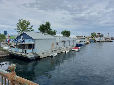
The ship channel under the Bascule bridge. Interesting camouflage job on the ship to the right (not that visible in this picture - is that due to distance or camouflage?)

The Docks driving range and former occasional drive-in (can still see the old screen on the left).

Another Hydro Building! "Edwardian Classical Styling" (from 1928). See also this document.

Old Essroc cement storage silos.

Lots of earthworks going on here in preparation for rerouting the mouth of the Don River. New bridge(s) over what will be the Don.

The end of the Gardiner Expressway that used to head further east. Bit of a sudden drop, but I'm sure there's a stop sign further up the road somewhere.

Another picture from below the end of the former expressway.

More chimneys - in this case the Commissioners Street transfer station incinerator which may still be in use for some waste. Hazardous waste and recycling also handled here.

Just behind this is the Mayfair Lakeshore club so the pollution can't be *too* bad.

Monday, 24 October 2022

Second set of walks around Toronto

'Around' Toronto this time, since I'm mostly not doing the East/West 'walking across Toronto'. (though Dundas is still to come so stay tuned).

Below is a map of the next set of walks, concentrating on East Toronto and (spoiler alert) seeing a lot of mansions downtown on Sherbourne and Jarvis. You can also see the first 6 walks map here. (And the third set of walks here).

This shows:

Click on the map below to see it maximum size. Click on a link above to see the blog for that walk.


Walking Toronto Streets - O'Connor Drive and St Clair Avenue East

This walk starts at the west end of O'Connor (Don Valley) and follows it east to St. Clair and then over to Victoria Park. Click on any picture to see a big version! Also part of this map.

O'Connor Drive is named after Frank Patrick O’Connor, who opened the first Laura Secord Candy store in Canada on Yonge Street in 1913 and was also a member of the Canadian Senate.

Starting at the corner of Broadview Avenue and O'Connor Drive is the Sisters of St Joseph aged care building. This really is a stunning building (see the next two pictures). You can read about it in this story from 2013.
The above picture shows the 'front' of the building (photo looking north-west).

The picture below starts at the far left of the above picture and looks north.

The Sisters of St Joseph mother house is just east of the above building. See info on the sisters and their history at: https://en.wikipedia.org/wiki/Sisters_of_St._Joseph

At the NW corner of Pape and O'Connor is the Don Mills United Church. There is a small cemetery beside it dating from 1822 (closed in 1958).

At Donlands Avenue 'The Wally' - scuzzy bar that we went to once and saw a cockroach on the bar. Didn't go back.

O'Connor is a little boring, so I made a 'hyperlapse' video of part of it - however it looks like I can't incorporate it into this blog so unless you follow me on Strava you won't be able to see it 😢. It showed the Shell and Esso stations at Coxwell and O'Connor so you can probably live without it.
Unless you can see this link?

OK, so there *is* an advantage to tiny cars 😀

There are some nice houses on the north side of O'Connor, set back quite far from the street.

O'Connor Drive Bridge over Taylor Creek. An expanded view of the house barely visible in the top left of this picture might be interesting...

...so here it is. Nicely tucked away.

Corner of O'Connor (left) and St. Clair (right). I took St. Clair for some reason - perhaps it would be too cold if I continued north-east on O'Connor.

St. Kosmas Aitolos Greek Orthodox Church. Will try and work out what the flesh-coloured shape is on the bottom right.

270° view of O'Connor and Victoria Park. Car front at far left is on O'Connor, and Vic Park is beside the sidewalk that curves to the right in the middle of the photo. No Frills food store and parking lot to the right.

And then I headed down to Victoria Park Station, so a couple of pictures of this section:

Dentonia Park par 3 golf course just north of the Victoria Park Subway Station. There is someone in the deep grass in the middle of the picture.

Many high-rises near the subway (and a school; looks like buses park on Vic Park during the day)

And finally, the Victoria Park Subway Station looking west.


Tuesday, 11 October 2022

First six walks across Toronto

 As part of my 'walking across Toronto' I mostly walked E-W at first. Below is a map of the first six walks documented on my blog.

This shows:

Also shows parts of other walks that I'll be documenting - parts of Dundas (stay tuned for that story!) and Kingston Road. Click on the map below to see it maximum size. Click on a link above to see the blog for that walk. (You can see my second set of walks here, and the third set of walks here).


Walking Toronto streets - Front

Another end-to-end exploration of a street - in this case Front Street. It runs from Bayview Avenue (just west of the Don Valley) through the downtown to Bathurst Street. Also part of this map.

Front Street is one of the original streets laid out for the Town of York and it followed the shoreline at that time. Now it is a fair distance from the lake!

This walk starts at the east end (Don Valley) and goes west. Click on any picture to see a big version!

This first picture is actually slightly south of Front at Bayview Avenue. It's a sculpture called "No Shoes"

Heading west, this is looking towards downtown from Front Street between Bayview Avenue and Cherry Street.

51 Division Police Headquarters - Front Street East and Parliament Street. A nicely renovated old warehouse building and very similar to the building I used to work in (see next picture!)

The old entrance to Castek Software at Front just west of Berkeley. The left part of the building (also a bit taller) is still the Canadian Opera Company. Castek unfortunately no longer exists.

Toronto Fire Station 333 (left) and new condos at Princess Street.

There's a library here somewhere - though the entrance is to the left of this picture. Rumour has it that someone I worked with - MO - was responsible for 50% of their business 😀

Inside the St Lawrence Market building.

Gooderham Building (aka Flatiron Building). 'YAGB' - Yet another Gooderham Building - for those who looked at my walk on Bloor, or those who somehow guess that I will walk along Jarvis and see a few more YAGB's.

A very cool fountain west of the Gooderham Building in Berczy Park. Multiple dogs, a bone at the top, and one cat (left of center and at the back of the fountain)!

Meridian Hall. Originally opened as the O'Keefe Centre in 1960. Then the Hummingbird Centre for the Performing Arts (1996), Sony Centre for the Performing Arts (2007), and now (2019) Meridian Hall.

Hockey Hall of Fame! A former Bank of Montreal building. Built in 1885 and was the only building on its block that survived Toronto’s Great Fire in 1904.

'Dominion Public Building'. Formerly Toronto's federal customs clearing house. Neat curving facade.

A few skyscrapers visible at Bay Street looking north. Royal Bank building (gold windows) on the left and TD Trust building on the right foreground.

Union Station. (Should have got a picture inside - beautiful high hall)

The Royal York Hotel (completed 1929). No longer dominating Toronto's skyline like it once did.

Front right is an old industrial building (1918) which is now bars (Loose Moose, Jack Astor's). The smaller darker red building in the middle used to have "Armadillo's" restaurant (great baked potatoes!). And the new building is a Cadillac Fairview office tower.

The CBC building at Front Street West and John Street. Get your photo taken on a bench on the Front Street side with (a statue of) Glenn Gould!

And, of course, another fairly tall building from the 70's.

Looking north up Spadina Avenue from Front Street.

The scale of this new development on the north side of Front west of Spadina Ave is hard to see from a picture. Many condos and office buildings will be here.

South of Front is where GO trains sleep after an exhausting morning of bringing commuters into the city, and prior to taking them home again.

Bathurst Street Bridge over the tracks south of Front. And the far western end of Front Street.

More condos on the NE corner of Front and Bathurst.

And Front Street ends at the Belgian Moon brewery 😀.