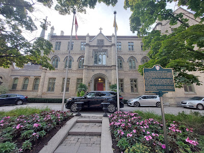
The second part of my 'Jarvis and Church' walk (link to part 1 here). Church street from its southern end, north until it curves around to Yonge Street and turns into Davenport Road. So many interesting things to see - some in my old 'hood.
Click on any picture to see a big version! Also part of this map.
Church Street
Starting at the far south end of Church Street, looking north.(Now to double back for some other buildings between the three big churches).
McVeigh's Irish Pub ('New Windsor Hotel') - at the SW corner of Church and Richmond for 53 years. Building dates to 1882. Will be incorporated into a condo development.
Church Street was also the location of a lot of pawn shops. Still a few here just north of Queen Street.
Mural on the south wall of the (now closed) Marquis of Granby Pub, which used to be the "...landmark gay destination The Barn" in the '80's and '90's.
There was a Loblaws here, just to the left of the 519, back in the '70's.
fb://photo/771018709668826?set=a.501092626661437\u0026sfnsn=mo
Originally one of the William St Croix houses (1877). https://www.acotoronto.ca/building.php?ID=13521
Traders Building (1956). Will be the site of more condos, though keeping much of the original building.
Salvation Army Grace Hospital is at Church and Bloor East
Curving apartment building following one of the curves on Church Street north of Bloor at Park Rd.


No comments:
Post a Comment