Monday, 16 February 2015

Block'd (Part 2)

Here's a more detailed follow-up on my original Block'd post with some practical advice for how you can get scores over 1,000,000 or so ('Marathon' mode). In order to get to a very high score (e.g. my high score is 100,410,143) you will need to learn to control boredom - above about level 40 or so you have effectively beaten the game and the rest is just rote play.
(My explanation of going so far is that I was interested to see if the high score would 'roll-over' correctly to 7 digits. My particular game - on my old Nokia phone - has some other glitches where it can screw up if you go over level 128, so there was *some* reason to believe that other issues may arise:-) )

As mentioned in the original post, the key strategy is to try and get the maximum points every 4th and 5th levels so you can maximize the number of 'wilds' that you have. Then, use these judiciously over the next few levels so that you have some available for the next big level.

So minimizing the overuse of 'wilds' can pay dividends. A few simple situations and how to handle them follow. These will probably only make sense if you either play the game, or have read the earlier post! And to use a chess analogy - this is kind of like learning the endgame positions so you can recognize how to win them, and which ones to avoid.

First, a simple case (see below). To clear this without losing lives you might think you should put a wild on the top right (red) block (to clear it and the yellow), then place a wild on the top left (red) block to clear the rest. However this has a simpler solution...just place a wild on the middle blue block and clear the bottom row, and then you can clear the two reds as they will be side by side.


Now that you've seen the general approach, here's a quiz. In all cases, how do you place the minimum number of 'wilds' in order to clear the level without losing lives.

1.      

2.     

3.    

Answers:
1. Just need 1 wild (on the white)
2. Just need 1 wild (on the bottom white)
3. Need 2 wilds (e.g. one on the right hand red, then one on the white)

And what you will have seen by now, is that you don't want to get a very simple end position like:


Since you need 2 'wilds' to clear this. Don't forget, you can place them both before clicking to clear. (e.g. place a wild on each of the green blocks then click to clear).

I probably won't do any more posts on Block'd, so my knowledge of the 'middlegame' strategies for 'Marathon' mode, as well as how to get high scores on the 'Speed' mode will probably be forever lost.

Saturday, 14 February 2015

Old and New Toronto - Pape and Withrow

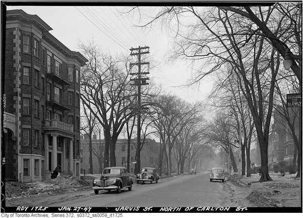
Probably not much here for anyone who doesn't live in the area, but a typical case of widening a road and removing trees. A little less 'grand' a street than Jarvis (prior to widening) perhaps, but typical of many.

Here's a picture of Pape, just north of Withrow and looking south (1917). Keep an eye out for that horse-drawn carriage (in the middle of the picture) later in this blog. There is an old mailbox on the far left, and note the lights all attached to the poles at quite a low height - maybe they weren't bright enough to be higher?


The widening occurred a few years later (1922). Here's what it looks like today.


I also found a picture taken from a spot just north of the above (and looking north) during the actual road widening (Aug 1922). (Wonder if that horse-drawn cart on the right is the same one as in the first picture?! It has a similar look, but can't see any wording on the back of the carriage in the top picture - may just be too dark or far away to see.)


Some other Toronto 'before and after' road widening pictures can be seen at:  http://www.blogto.com/city/2011/10/that_time_when_toronto_widened_the_streets/.


Thursday, 12 February 2015

Old and New Toronto - Withrow Park

I had found the following old picture online - showing skaters near the North East corner of Withrow Park (1923). Since it is close to where we live and many of the buildings are still around I thought I'd take a more recent look.


The nearest building (toward the left center) is still there (washrooms) and the houses in the background (along Logan Avenue) are mostly still there.


When you look at this today, there is a new building (Clubhouse) to the right of the washrooms, but even in winter the houses along Logan are almost impossible to see. Lots of tree growth in the last 90 years!

The original picture was probably taken from slightly farther North (to the right) than the above, but that is now landscaped more and didn't seem to compare quite so well - I include it below for interest.


And to think that the area that is now Withrow Park was once planned to be just a continuation of the surrounding streets and houses.

The 1899 Goad Map shows Withrow Park as proposed streets and housing. It also shows each house that had been built so far! And if you look closely you can see our house - the first one on Withrow between Pape and Carlaw.

The 1910 Goad Map shows Withrow Park as a park and the rest, as they say, is history :-)

ps If you like exploring old maps, this link is pretty neat: http://peoplemaps.esri.com/toronto/ You can move around kind of like Google Maps, and can choose different years (slider in the top right).


Old and New Toronto - King Looking E From University

Number four in the series of old and new pictures of Toronto. What looks like a somewhat boring corner now (King St W, looking East from University) still has one interesting older building visible.

I had found this picture (below - and again, from the 'Flashbacks 1' postcards book) and thought I'd check it out (it being very close to work too). This is King Street West, looking East from University Avenue (circa 1886).


The building in the center is the Rossin House Hotel, demolished in 1969. Given that there's nothing much visible today (see below) I wasn't even going to publish this picture, except that the (circled) building in the background - partially obscured by the light pole - looked interesting, somewhat older, but wasn't even in the first photograph.


Then, I found another old (but more recent than the first) photo, from 1936 taken from almost the same spot (just from the South side of King) and there it was - the tall building on the right in the background. It's now called Commerce Court North (above) but was the *Bank of Commerce* building in 1936. They merged with the Imperial Bank of Canada in 1961. And this was once the tallest building in the Commonwealth.


And the other tall building (closer, and in the left-center of the picture) is the original Toronto Star building - used as the model for the Daily Planet in Superman comics but sadly no longer around.

20150213 - Update: Thanks to Mark Brader for both giving me the dates for the Bank of Commerce building, correcting other errors I managed to introduce, and pointing out the interesting crossover between the streetcar tracks in the first (oldest) photo. "The streetcars then in use were symmetrical:
http://upload.wikimedia.org/wikipedia/commons/f/f8/Horse_drawn_streetcar_Toronto_1880s.jpg
so a short-turn just required moving the horses to the other end and setting the switch to go into the crossover."
Easy to miss, but then something that I won't miss in future (or is that "in the past"?)!

Saturday, 31 January 2015

Old and New Toronto - Old Don Railway Station

This was a slightly more difficult photo to find an equivalent for, since it looks like the Don Valley has been significantly 'terra-formed' in this area. I had first found this picture (below) when looking at some old 'lost' railway stations in Toronto:


It was originally located just south of Queen St on the west side of the Don River. At that time, the Queen Street bridge was lower and just went over the river. This changed a lot when the new high level Queen Street bridge was built (starting in 1911). See also the Toronto Railway Historical Association's site.

I took the following from between a couple of new buildings just south of where Queen and King come together just west of the Don.


Although the central part of the bridge has a similar look to the first photo, it's not the same structure (and is probably about 20' above where the original was). There are still train tracks running along the road (Bayview extension) which is visible around the middle of this picture. So the original station was probably on the road between the front end loader and the back hoe. Update: Actually - assuming the river and the tracks haven't moved, then the true position would likely be on the other side of the tracks, where the stairs down to the walking trail are. Here's my best guess:


Turns out that Don Station had been saved and moved to Todmorden Mills in the Don Valley in 1969. Interestingly, we had gone there about 10 years ago (Oct, 2005) and I had taken pictures of it (see below).


Time to go take another look - but not at the same location it seems, since it was moved again in 2009 to a new location downtown. See it here at Roundhouse Park, or see this wikipedia article which has some more information including a picture very similar to mine.

Friday, 30 January 2015

Old and New Toronto - Bay by Old City Hall

On the same (bitterly cold) day as my previous post, I walked a block north on Bay and took a photo to try and capture the same scene as the postcard below. The description on the back read:

"Torontonians take to the streets following the news of 'Victory in Europe', May 8, 1945.
A Victory Bond Drive promotion decorates the City Hall's clock tower."


And here it is today:


The buildings to the left have changed a lot, and the near buildings on the right. But the lower part of the 'Hudson's Bay' building is (a somewhat modernized version of) the original, and of course old city hall is much the same. I notice that my photo shows the gargoyles near the top of the clock tower better than the original . (The clock itself is cut off in both photos)

20150202 Update: The original picture shows a symbol (the number '8' in a wreath) both on the bottom of the donation thermometer and also along the side of the Simpson's store. Thanks to Mark Brader for finding out that it was a temporary symbol -- the 8 refers to the 8th victory-bond drive of the war, a 20-day campaign that had started on April 23. See also further information at this page on 'National Flags of Occasion'.

20150204 Update: I was sure that I should have been able to see at least a couple of gargoyles on the original clock tower picture - then found this:
"Four gargoyles were placed on the corners of the Clock Tower in 1899, but they were removed to the effects of the weather on the sandstone carvings in 1938. In 2002, bronze casts of the gargoyles were reinstalled. The replicas are not duplicates as the original designs were lost."
That was from http://en.wikipedia.org/wiki/Old_City_Hall_(Toronto)

According to http://tayloronhistory.com/2012/04/22/enjoying-torontos-architectural-gems-old-city-hall/ one of the gargoyles actually fell off and went through a roof. This link also contains some interesting background including how the architect Lennox had the letters of his name carved under the eaves...I'll have to drop by and take a look.

Wednesday, 28 January 2015

Old and New Toronto - Bay and Adelaide

I had always wanted to take some current photos at the same location as some old historical photos, and show the differences. And since I have a couple of books of postcards showing old photos of Toronto (pictures are from the City of Toronto Archives) - what could be easier? Click on any photo to enlarge it.

I started with a photo from the 'Flashbacks 1' set. The description on the back read:

 "A city traffic officer attends to his semaphore at the Bay-Adelaide intersection, 1922.
Hotel Widmer is on southwest corner."


Since I work nearby - and since it was bloody cold today - the stars were obviously aligning for me to try and get a similar shot. I think it's tough to know what relative focal length the original photographer used, and I found that my shots tended to show the vertical lines as 'leaning in' more. I think this is due to the camera not being totally level - as I angled it very slightly up in order to get more building in the frame.


Anyway, it looks to me as though there is still one building around. In the original photo if you follow the Hotel Widmer to the left (down Bay St) there is a three story building, then a gap and then another building. That last building looks like it still exists in the more recent photo - and there's a low building where the gap was. The last building also has a half dozen extra floors from the original photo.

More to come!

(2015-02-02 Update: The Widmer Hotel doesn't seem to be mentioned too much, but I found this interesting story about a Captain Jackman who had died and one of his sons lived at the Widmer Hotel. This son was Harry Jackman - but not the same Jackman family as Henry Rutherford (Harry) Jackman and his well-known son Hal Jackman.)

(2015-06-02 Update: Another Widmer Hotel picture from the past (just click on the picture, or the 'Click here to view/add tags' link on that page). Looks like someone else still doing the 'stop/go' traffic control - and once again it's nasty looking weather - this time in 1928)

(2015-07-23 Update: The building on the left (that now has a half dozen extra floors) has 'Bank of Montreal' carved on its front. And the corner building has 'Canada Permanent Building' carved into its stone.)